Showing 17–32 of 38 results
-

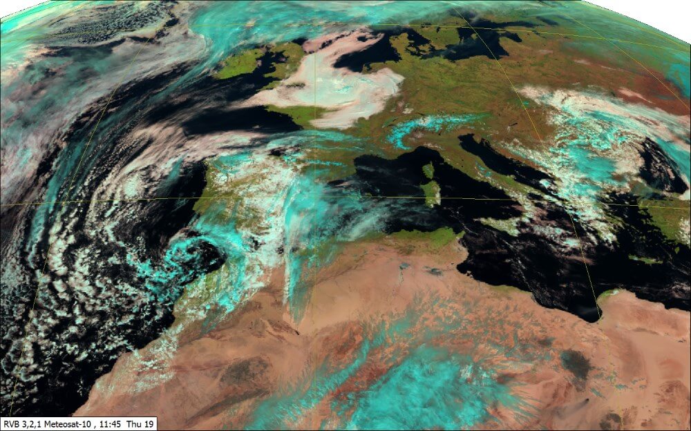
Your needs The high definition satellite images are an essential tool for forecaster, for weather analysis, monitoring and nowcasting. It allows to locate the main cloud masses (storm systems, tropical cyclones …) and to identify the type of clouds. The animation of these images also provides a clear insight of the evolution and the movement of the cloud masses. Satellite imagery helps detect and forecast high impact weather, such as thunderstorms or fog. All stages of convection can be monitored, from the initial instability in the atmosphere, to the development and properties of mature thunderstorms. Volcanic ash clouds, which are important for air traffic management, can be detected. Weather forecasting centres need satellite imagery to perform their duty.
-

The MOBILE MET PLATFORM has been designed and adopted as theatre MET centre. In case of force projection, it enables work of the forecasters and guarantees an optimum quality of meteorological briefing to pilots. The French Air Force and the French Army chose the MESSIR systems developed by COROBOR because of their established reputation as high performance systems in the world of meteorology and their fully integrated configuration.
-
Weather has an impact on most of human activities such as transportation, construction, military activities, agriculture, and fishing. Accurate weather forecasting improves human life, property and natural resources protection. MESSIR-VISION is a sophisticated software for the forecasters. Allowing to: Acquire real-time data and products from various data sources. Store these data online to keep them at the immediate disposal of forecasters. Provide them with a rich set of on-screen tools to produce forecasts, issue warnings and take decisions. Disseminate forecasts/warnings to users. This Forecaster Workstation runs on a standard Windows PC, which may include up to 4 screens. MESSIR-VISION integrates into one compact system all data needed for weather forecasting: surface and upper-air observations, numerical weather predictions (models), satellite and radar imagery…
-
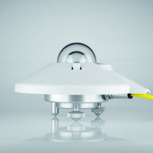
Spectrally flat Class A pyranometer for accurate solar irradiance measurement in low-maintenance applications. Internal 10-year drying cartridge, IP67, −40 to 70 °C, no dedicated power supply.

-
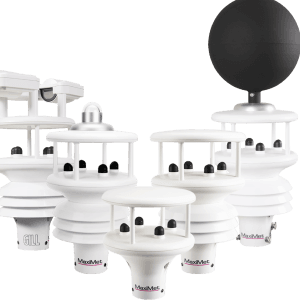
Compact, integrated multi-sensor weather station delivering high-quality meteorological measurements with minimal maintenance and low power consumption.

-

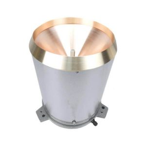
Meteorological thermometers are used for measuring the temperature of the atmosphere and are primarily in the form of maximum and minimum or normal reading thermometers. Sheathed screen thermometers are made to BS692 standard for use in a Stevenson's screen.
Russell Scientific Instruments
-

Weather, and particularly severe weather events, can significantly impact airlines and airport operations. The frequency and severity of these extreme events, and the resulting losses have been increasing for the last few decades. Greater disruption to global aviation services may be anticipated. Lightning is one of the most dangerous and frequently encountered weather hazards. It can crucially and significantly disrupt the operations of airlines, airports and air traffic control. Leveraging meteorological science and technological advances promises fresh opportunities to mitigate these impacts and better manage disruptions.

-
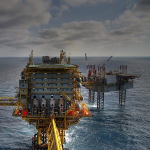
MetraWeather provides a portfolio of forecasting products and services to anticipate and meet the unique and changing needs of the oil & gas industry.
-

Accurate, up to date, stunning weather visualisations. From pay-as-you-go Scenes offered online as required, to our top of the range Weatherscape XT Enterprise system
YOU CHOOSE HOW YOU SHOW OUR WEATHER!
-

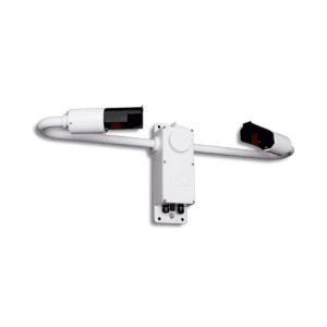
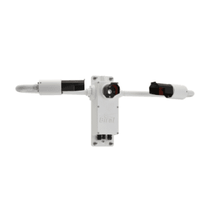
The Doppler SODAR PA-XS electronic case includes GPS, WiFi, digital compass and 2D inclinometer. Pressure, temperature and humidity measurements are included. Wireless modem and/or satellite connections are available.
-

The Doppler SODAR PA0 electronic case includes GPS, WiFi, digital compass and 2D inclinometer. Pressure, temperature and humidity measurements are included. Wireless modem and/or satellite connections are available.
-

The Doppler SODAR PA5 electronic case includes GPS, WiFi, digital compass and 2D inclinometer. Pressure, temperature and humidity measurements are included. Wireless modem and/or satellite connections are available.
-
The RIMCO RIM7499 range of siphon controlled tipping bucket rain gauges are professional instruments designed and constructed for long-term operation with minimal maintenance under all climatic conditions. All materials are corrosion resistant. These proven instruments are accurate to within 1% for rainfall rates up to 200mm/hr and 3% up to 380mm/hr. This rain gauge can be used for several applications, such as general meteorology, hydrology, flood warning systems, remote and long-term logging deployments.
-
The Biral SWS-100 is a compact forward scatter visibility sensor for road weather, aviation, and transport applications, measuring visibility MOR from 10m to 20km.


-
The Biral SWS-250 is a high-accuracy forward scatter visibility and present weather sensor reporting 39 WMO codes, designed for ICAO-compliant aviation meteorology and professional weather networks.
-

- Vaisala BAROCAP® sensor
- Accurate measurement
- Excellent long-term stability
- Added reliability through redundancy
- Graphical trend display with 1-year history data
- Altitude corrected pressure (QFE, QNH)
- For professional use in meteorology, aviation, laboratories, and demanding industrial applications
